


The City of Sails: Harbor Horizons and Volcanic Peaks in Auckland
Auckland, known natively in Te Reo Māori as Tāmaki Makaurau (the land coveted by many), is a city defined entirely by its geography. Positioned on a narrow isthmus between the Tasman Sea and the Pacific Ocean, New Zealand’s largest metropolis manages a rare feat: it marries a sleek, modern skyline with an active volcanic field and pristine marine reserves.
For travelers and creators, Auckland offers an incredibly diverse visual palette. In a single afternoon, you can pivot from the high-end industrial design of the Britomart precinct to the rugged, black-sand surf beaches of the wild west coast.
1. The Marine Grid: Waitematā Harbor
To understand Auckland's layout, one must look to the water. The city boasts the highest boat-ownership per capita in the world, a statistic immediately evident when looking out over the Waitematā Harbor. The skyline is anchored by the iconic Sky Tower, slicing through the clouds at 328 meters, while the historic ferry terminal buildings anchor the bustling waterfront below.
The waterfront architecture blends heritage red-brick facades with modern, open-air pedestrian boardwalks, creating a dynamic structural grid where urban life meets the sea.
"Auckland does not merely sit alongside the Pacific; its identity is carved by it."
2. Volcanic Topography: The Green Cones
Underneath Auckland's urban bustle lies a dormant volcanic field containing over fifty distinct cones. These structural landmarks have been reclaimed by nature and time, transformed into lush, emerald-green parklands that interrupt the concrete grid.
The design language of these sacred spaces is characterized by:
- Terraced Earthworks: Ancient Māori fortified village (pā) remnants layered into the hillsides.
- Panoramas: Unobstructed, 360-degree views of both the Pacific and Tasman shorelines from the summits.
- Basalt Structures: Deep, volcanic stone textures woven into the city's historic walls and coastal paths.
Visual Exhibition
Using dynamic framework compilation, we can capture Auckland's contrasting urban and natural environments. By arranging high-resolution, CDN-delivered imagery into a responsive Tailwind CSS flexbox layout, we can experience the city's unique geography at a glance.
Gallery
3. Regional Highlights: The Surrounding Landscape
Auckland's greatest asset is its accessibility. Within a 40-minute ferry ride or drive, the cityscape completely dissolves into dramatic wild spaces.
| Destination | Core Element | Dominant Aesthetic Tone |
|---|---|---|
| Viaduct Harbour | Urban Marina | Yacht White & Deep Navy |
| Mount Eden (Maungawhau) | Volcanic Crater | Velvet Green & Volcanic Black |
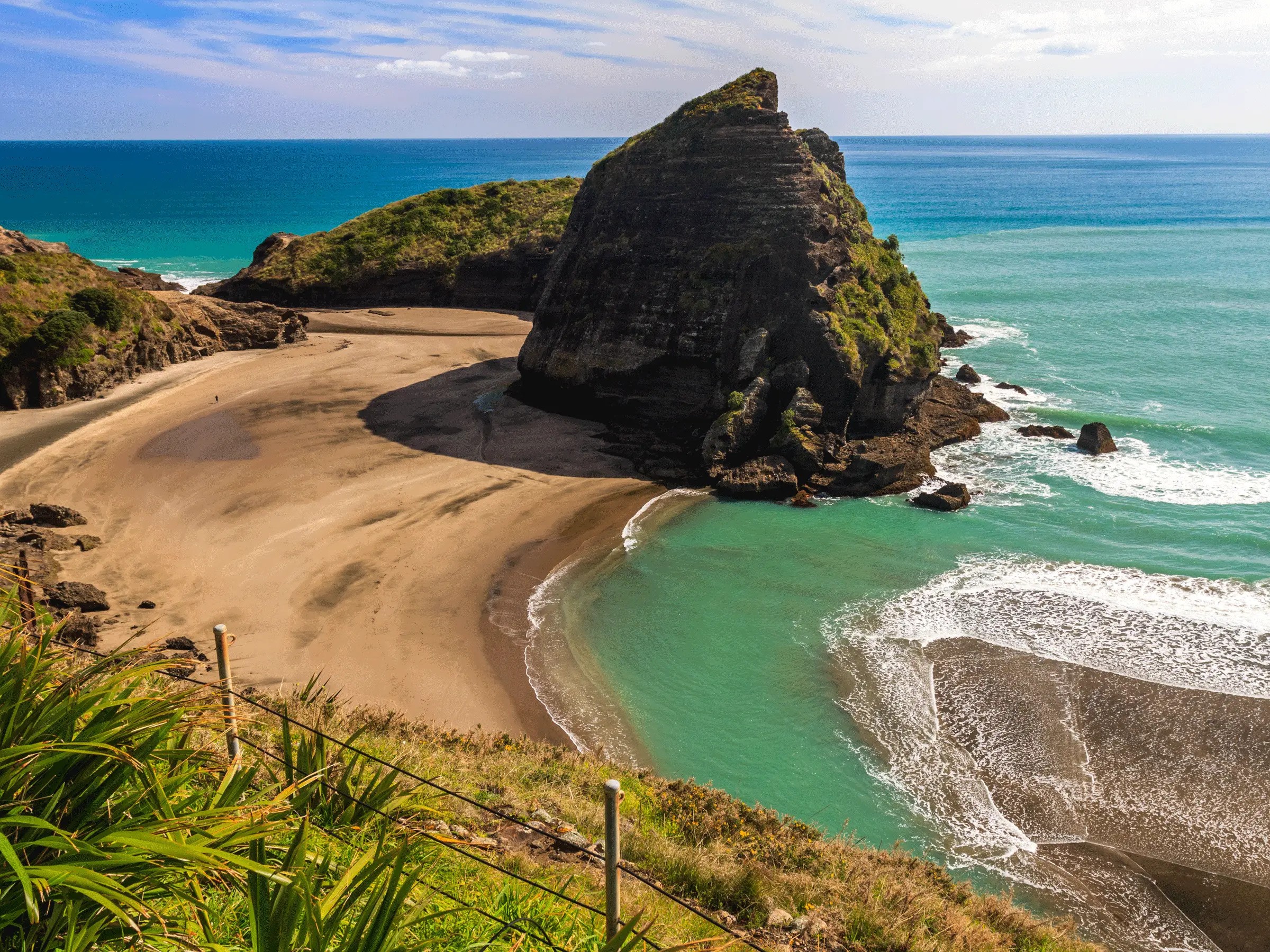
| Piha Beach | Coastal Wilderness | Iron Sands & Crashing White Surf |
| Waiheke Island | Wine & Coastline | Olive Green & Teal Water |
Conclusion: Balancing City and Coast
Auckland shows us that urban living doesn't have to mean sacrificing a connection to the natural world. It is a city that moves to the rhythm of the tides, keeping one foot in global commerce and the other in the pristine expanses of the South Pacific. By using responsive frontend systems like MDX and Tailwind, we can catalog these intersecting landscapes cleanly and efficiently.